
About this walk
This is the long way to the caves, mostly on fire trails. If you would rather reach them on a shorter walk, see the Ritcher's Cave Short Walk.
There is plenty of lovely rainforest and a good amount of climbing, so it is great for getting fit. The caves can be tricky to find, so if you are going looking for them, tell someone where you are going and when you expect to be back. Allow half a day.
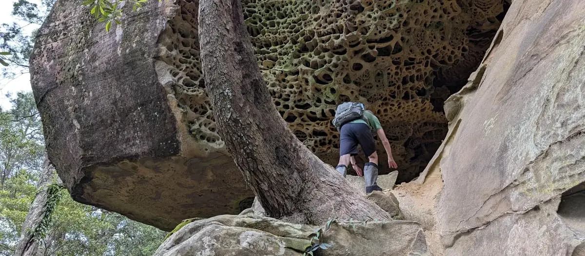
Scrambling over the rocks at the base of the cliff is a lot of fun, but watch your footing. Few people walk here, and there are large sections of fallen honeycombed rock that may be thinner than they look. The last part to the caves is less a bushwalk and more a bushbash (pushing through bush with no track), so follow the map on this page.
What should you bring on the Ritcher's Cave walk?
Bring a daypack with 3 to 4 litres of water, snacks, lunch, a first aid kit and a 3 m length of climbing tape. There is a lot of hill and a lot of fire trail on this walk, so carry 3 to 4 litres of water, or more on a hot day.
Directions
- Start on Yarramalong Road. It looks and feels like you are parking on private property, so park near the fence: -33.267469898574355, 151.33615493774414 (Google Maps)
- You have arrived at the campsite. Head to the back of the campsite, to the east, until you see the path, which is slightly south east: -33.27509, 151.31211 (Google Maps)
- Follow the track until you reach a large rock platform. The path down to the caves is just before it, in the dry riverbed or ravine, and looks too steep to be a path: expect some bum shuffling. If you reach the rock platform you have gone a bit too far. Once you are down, follow the cliff line just below the 250 m contour, with some climbing now and then: -33.27565, 151.3145 (Google Maps)
- After the caves end, head back up another ravine to the road: -33.27629, 151.31168 (Google Maps)
- Turn right onto the road and head back to the start: -33.27579, 151.31147 (Google Maps)
Elevation
- Climb
- 290 m
- Descent
- 60 m
- Highest
- 275 m
- Lowest
- 27 m
Approximate, from a 30 m terrain model, so it can overstate the climb on cliff edge tracks.
Before you go
Tell your people where you are going
Set your route and return time in FriendsFindMe. If you do not check in, the people you trust are sent a text so they know to come looking for you.

The book
11 walks with campsites in the book
A Cornucopia of Central Coast Walks lists 11 walks with campsites, from Little Beach in Bouddi to Upper Mangrove to Wisemans Ferry. It also has my guide to planning a multi day hike and the list I pack for a night out.
See the bookThe original walk notes and photos on Good Architect
Park and state forest boundaries: CAPAD 2024 © Commonwealth of Australia (DCCEEW), CC BY 4.0; © Forestry Corporation of NSW, CC BY 3.0 AU; © State of Queensland, CC BY 4.0; © State of Victoria (DEECA), CC BY 4.0