
About this walk
This is the shorter way in to the cave, although the drive is longer, so if you want more time on your feet and more climbing, try the long Ritcher's Cave walk instead. The road in really suits a 4WD. If you don't have one, either do the longer walk or park at the carpark 2km before the start of this walk and begin from there.
There is plenty of lovely rainforest and a good amount of climbing, so it is great for getting fit. The caves can be a bit tricky to find, so if you are going looking for them, tell someone where you are going and when you expect to be back. Allow a whole day.
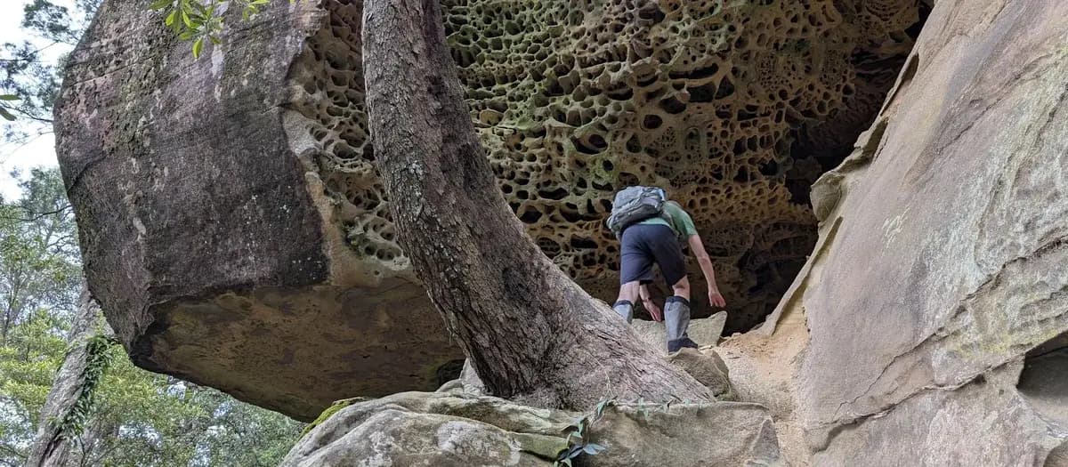
Scrambling over the rocks at the base of the cliff is a lot of fun, but watch your footing. Not many people walk here, and there are big sections of fallen honeycombed rock that may be thinner than they look. It is less a walk than a bushbash: pushing your own way through the scrub.
Directions
- Start on Red Hill Road, which carries on from Forest Road. Google may try to send you in from the south. Change it to the "longer option" from the north, off Bumble Hill Road, to keep the 4WD driving to a minimum: -33.27849, 151.30778 (Google Maps)
- When you reach the campsite, go to the back of it on the east side until you see the path, slightly south east. The path is behind the campsite and a little to the right: -33.27509, 151.31211 (Google Maps)
- Follow the track until you reach a large rock platform. The way down to the caves is just before it, in the dry riverbed or ravine that looks too steep to be a path, and some bum shuffling is needed. If you reach the rock platform you have gone a little too far. Once you are down, follow the cliff line just below the 250m contour, with some climbing now and then: -33.27565, 151.3145 (Google Maps)
- After the caves end, climb back up another ravine to the road: -33.27629, 151.31168 (Google Maps)
- Turn left onto the road and walk back to the start: -33.27579, 151.31147 (Google Maps)
What should you bring?
Pack a daypack with 2L of water, snacks, lunch, a first aid kit and a 3m length of climbing tape.
Elevation
- Climb
- 50 m
- Descent
- 100 m
- Highest
- 335 m
- Lowest
- 242 m
Approximate, from a 30 m terrain model, so it can overstate the climb on cliff edge tracks.
Before you go
Tell your people where you are going
Set your route and return time in FriendsFindMe. If you do not check in, the people you trust are sent a text so they know to come looking for you.

The book
42 secret walks in the book
A Cornucopia of Central Coast Walks has a secret walks section with 42 walks most locals have never heard of, from loops under a kilometre to full days out over 10km. Each one has a map and numbered directions.
See the book