
About this walk
This is one of the marked sections of the Investigator Trail in Lincoln National Park, on the tip of Eyre Peninsula south of Port Lincoln. It runs west from the main park entrance (checkpoint 1) to the northern end of Pillie Lake (checkpoint 2). It is 7.8 kilometres and about 2 hours 30 minutes one way, and is rated a moderate hike, suited to walkers of average fitness with some inclines and uneven ground.
What it is like
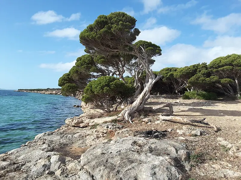
It is a quiet trail through varied vegetation that skirts the coast with views over Proper Bay, the sheltered water between the park and Port Lincoln. Spring brings a strong show of wildflowers. The country here is coastal mallee and scrub, home to heath goannas and to the western whipbird, a nationally threatened bird that keeps to dense mallee and heath and is far easier to hear than to see. The trail is marked with numbered checkpoints that match the park's bushwalking brochure.
How it links up
The Investigator Trail takes its name from HMS Investigator, the ship Matthew Flinders sailed while charting this coast in 1802. Inside the park it is a set of sections you can walk alone or join into treks, and outside the park it carries on another 31 kilometres through Tulka and Port Lincoln to North Shields. From the Pillie Lake end you can continue on Taylors Landing to Pillie Lake (12 kilometres) or on the 26.3 kilometre trek to Sleaford Mere and back to the entrance. From the entrance the trail also heads north east towards Stamford Hill.
Getting there and facilities
The entrance is 13 kilometres south west of Port Lincoln along Proper Bay Road, about 680 kilometres and 8 hours by road from Adelaide. Vehicle entry is $14.40 per vehicle and must be paid before you arrive. The park has no drinking water, so carry your own: allow 2 litres per person for every half day and do not rely on tanks. Campgrounds with toilets include Surfleet Cove, Taylors Landing, September Beach and Fisherman Point, and sites must be booked and paid for ahead. Dogs are not permitted, partly because 1080 fox bait is laid in the park.
Before you go
Late winter and spring are the best months for walking; summer is hot and dry. Wear a hat and sturdy shoes, and tell someone your route and return time. Fire restrictions usually apply from November to April. Check the National Parks SA closures and alerts page and the Lincoln National Park page, and download the Lincoln bushwalking brochure before you go.
Elevation
- Climb
- 70 m
- Descent
- 70 m
- Highest
- 35 m
- Lowest
- 1 m
Approximate, from a 30 m terrain model, so it can overstate the climb on cliff edge tracks.
Before you go
Tell your people where you are going
Set your route and return time in FriendsFindMe. If you do not check in, the people you trust are sent a text so they know to come looking for you.
Park and state forest boundaries: CAPAD 2024 © Commonwealth of Australia (DCCEEW), CC BY 4.0; © Forestry Corporation of NSW, CC BY 3.0 AU; © State of Queensland, CC BY 4.0; © State of Victoria (DEECA), CC BY 4.0
Walk data: Recreation Trails © Crown in right of the State of South Australia (Department for Environment and Water), CC BY 4.0