
About this walk
The Cape Raoul Track runs out to Cape Raoul, on the southern coast of the Tasman Peninsula, in Tasman National Park. It is one of Tasmania's 60 Great Short Walks. It is 14 kilometres return in about 5 hours, Grade 4: bushwalking experience recommended, with tracks that may be long, rough and very steep and limited signage. This route is the one way walk from the car park at the end of Stormlea Road to the cape, so you walk it twice.
What it is like
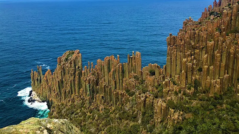
The track climbs through open forest and comes out suddenly at the top of the sea cliffs, about 300 metres high, with views along the coast. From there it stays close to the cliffs through heath and light forest, then descends steadily onto the Cape Raoul plateau. The cape itself is a mass of dolerite columns, rock that cooled about 175 million years ago and cracked into tall six sided pillars, dropping into the sea. Watch for seals on the rocks and small islands below. Part of the track is shared with the route to Shipstern Bluff, a big wave surfing spot.
The cape was named after Joseph Raoul, a pilot on Bruni d'Entrecasteaux's French expedition of 1793. In the late 1800s Royal Navy ships fired on the columns at Cape Raoul and Cape Pillar for target practice, and an 1856 painting by Louisa Anne Meredith shows more and taller columns than stand today.
The cliff edges are unfenced. The cliffs are hazardous and the track edges unprotected, so supervise children.
Getting there
From Port Arthur drive about 8 kilometres west on the B37, turn left at the Highcroft and Stormlea sign at Parsons Bay Creek, then follow Stormlea Road for 9 kilometres of dirt to the car park. Coming from Nubeena, the turn is 3 kilometres south of town. The park is about 90 minutes from Hobart on sealed roads via Sorell and the Arthur Highway.
Facilities and rules
There are toilets and a boot wash station at the start and nothing else on the track. Carry a trowel and bury toilet waste at least 100 metres from water and tracks. Tasman National Park is a fuel stove only area, so no campfires. You need a valid Tasmanian national parks pass.
Before you go
Tasmanian weather can change quickly at any time of year, and the cliff tops are exposed to wind. Carry water, a warm layer and a rain jacket. Check the Cape Raoul page and the Parks and Wildlife Service alerts page before you go.
Elevation
- Climb
- 560 m
- Descent
- 780 m
- Highest
- 440 m
- Lowest
- 7 m
Approximate, from a 30 m terrain model, so it can overstate the climb on cliff edge tracks.
Before you go
Tell your people where you are going
Set your route and return time in FriendsFindMe. If you do not check in, the people you trust are sent a text so they know to come looking for you.
Park and state forest boundaries: CAPAD 2024 © Commonwealth of Australia (DCCEEW), CC BY 4.0; © Forestry Corporation of NSW, CC BY 3.0 AU; © State of Queensland, CC BY 4.0; © State of Victoria (DEECA), CC BY 4.0
Walk data: LIST Transport Segments from theLIST © State of Tasmania, CC BY 3.0 AU