
About this walk
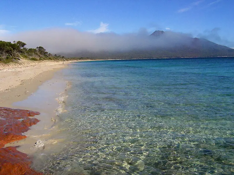
The Hazards Beach Track is the first leg of the Freycinet Peninsula Circuit and the return leg of the popular Wineglass Bay and Hazards Beach day circuit, in Freycinet National Park on Tasmania's east coast. This walk starts at the southern end of Hazards Beach, where the Isthmus Track from Wineglass Bay and the Peninsula Track meet, and runs north along the beach and around the western foot of the Hazards to its junction with the Wineglass Bay Lookout Track, a short walk from the walking tracks car park. The car park to Hazards Beach campsite stage is 7 kilometres and about 2 hours of easy walking.
What you see
From the car park the track rounds the headland below Mount Mayson through coastal heath, blue gum woodland and sheoak forest, with views across Great Oyster Bay and occasional dips into seasonal creeks. Hazards Beach is about 3 kilometres long. Look for the big mud oysters in the shell middens and washed up on the sand, which gave Great Oyster Bay its name. Walk on the wet sand to avoid disturbing nesting shorebirds. Freycinet sits within the country of the Oyster Bay nation, and the Aboriginal shell middens along this coast are significant cultural sites, so leave them undisturbed.
Day circuit or overnight
As a day walk, the Wineglass Bay and Hazards Beach circuit is 11 kilometres, 4 to 5 hours, Grade 4: over the saddle to Wineglass Bay, across the isthmus, then back along this track. This last stretch can feel longer than you expect. On the three day Peninsula Circuit, go anticlockwise, starting down this western side, to limit the spread of Phytophthora, a soil disease that causes root rot.
Facilities
The Hazards Beach campsite is at the far southern end of the beach among blue gums, banksias and sheoaks, with a composting toilet. Water from Lagunta Creek is unreliable; boil it before drinking. Camping is free and cannot be booked. The car park has toilets and a tap. Freycinet is a Fuel Stove Only Area: no fires, and no stoves at all on Total Fire Ban days. Ross River virus is present, so bring insect repellent.
Getting there
Turn off the Tasman Highway onto Coles Bay Road 12 kilometres south of Bicheno and drive 28 kilometres on a sealed road through Coles Bay to the park entrance, then on to the walking tracks car park. You need a Tasmanian parks pass. Beaches are unpatrolled.
Check the Parks and Wildlife Service alerts page before you go. Details are on the Wineglass Bay and Hazards Beach page and the Peninsula Circuit walk notes.
Elevation
- Climb
- 110 m
- Descent
- 70 m
- Highest
- 51 m
- Lowest
- 6 m
Approximate, from a 30 m terrain model, so it can overstate the climb on cliff edge tracks.
Before you go
Tell your people where you are going
Set your route and return time in FriendsFindMe. If you do not check in, the people you trust are sent a text so they know to come looking for you.
Park and state forest boundaries: CAPAD 2024 © Commonwealth of Australia (DCCEEW), CC BY 4.0; © Forestry Corporation of NSW, CC BY 3.0 AU; © State of Queensland, CC BY 4.0; © State of Victoria (DEECA), CC BY 4.0
Walk data: LIST Transport Segments from theLIST © State of Tasmania, CC BY 3.0 AU