
About this walk
The Peninsula Track is the southern and longest part of the Freycinet Peninsula Circuit in Freycinet National Park, on Tasmania's east coast. This walk starts at the southern end of Hazards Beach, follows the coast south to Cooks Beach, then turns inland over the shoulder of Mount Graham and comes down to Wineglass Bay, ending near the campsite where the Isthmus Track crosses back to Hazards Beach. The whole circuit from the Wineglass Bay car park is 27 kilometres over 2 to 3 days, Grade 3, which means some bushwalking experience and short steep sections with rough ground and many steps.
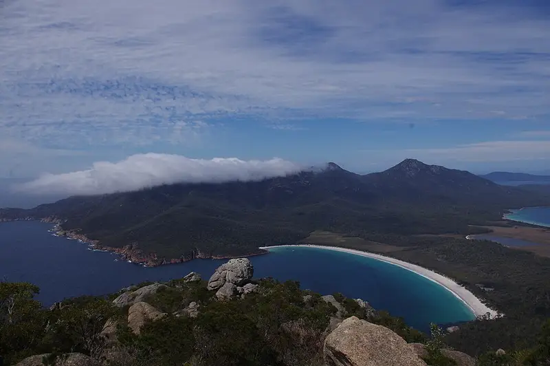
The peninsula is two worn blocks of granite, the Hazards and the Mount Graham and Mount Freycinet range, joined by the sandy isthmus behind Wineglass Bay. Freycinet was reserved in 1916, making it, with Mount Field, Tasmania's oldest national park.
The route
From Hazards Beach to the campsite at Cooks Corner is 5 kilometres and about 1.5 hours of easy coastal walking through heath, woodland and sheoak. Cooks Beach is about 1 kilometre long, and historic Cooks Hut, whose stone section dates from 1859, stands about 100 metres inland. It is for emergency use only. A side trip to Bryans Corner is 3 kilometres, about 2 hours return, with no camping there.
From Cooks Beach to Wineglass Bay is 11 kilometres and 6 to 8 hours, with about 500 metres of climbing through heathland, woodland and wet forest. The climb onto Mount Graham is steep and gives views south to the tip of the peninsula and Schouten Island. The descent takes about 2.5 hours, along a ridge of buttongrass moorland, down into the Graham Creek valley and over another ridge to Wineglass Bay. Mount Freycinet, the peninsula's highest point, is an optional side trip of 1.5 kilometres return and about 2 hours; it is steep, difficult in places and only roughly marked, so plan for it rather than add it on a whim.
Water and camping
Water is the main planning problem. Cooks Beach has a tank at Cooks Hut that may be empty, creeks on the climb are unreliable, and Wineglass Bay campsite has no water at all, so fill up at Cooks Beach with enough to get back to the car park. Boil any water you collect. Winter, when creeks run more reliably, suits this walk. Cooks Corner and Wineglass Bay both have composting toilets. Camping is free and cannot be booked. Freycinet is a Fuel Stove Only Area, and no stoves may be lit on Total Fire Ban days.
Getting out
From Wineglass Bay it is about 4 kilometres and 1.5 hours over the saddle in the Hazards to the walking tracks car park, which has toilets and a tap. Walk the circuit anticlockwise to limit the spread of the root rot disease Phytophthora. You need a Tasmanian parks pass.
Check the Parks and Wildlife Service alerts page before you go, and read the Freycinet Peninsula Circuit walk notes and overnight camping page.
Elevation
- Climb
- 720 m
- Descent
- 710 m
- Highest
- 562 m
- Lowest
- 1 m
Approximate, from a 30 m terrain model, so it can overstate the climb on cliff edge tracks.
Before you go
Tell your people where you are going
Set your route and return time in FriendsFindMe. If you do not check in, the people you trust are sent a text so they know to come looking for you.
Park and state forest boundaries: CAPAD 2024 © Commonwealth of Australia (DCCEEW), CC BY 4.0; © Forestry Corporation of NSW, CC BY 3.0 AU; © State of Queensland, CC BY 4.0; © State of Victoria (DEECA), CC BY 4.0
Walk data: LIST Transport Segments from theLIST © State of Tasmania, CC BY 3.0 AU