
About this walk
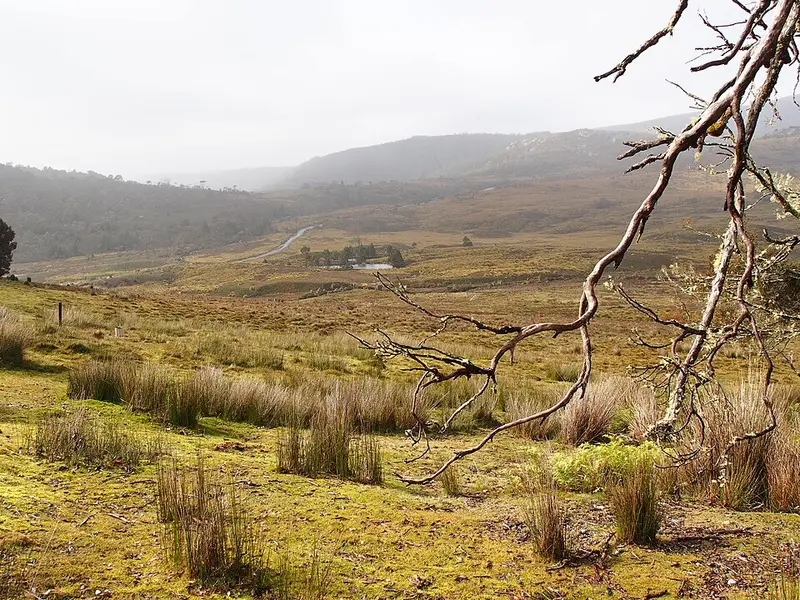
Hounslow Heath is an open plateau above Cradle Valley in Cradle Mountain-Lake St Clair National Park. This track links Waldheim, where Gustav Weindorfer built his chalet, with the western end of the Maryland Track: from Waldheim it climbs through Weindorfer's Forest onto the heath, crosses it, and drops to the Maryland Track junction. Walkers usually join the two into a circuit, returning along the Maryland Track through Cradle Valley. This walk is shown the other way, from the Maryland Track junction to Waldheim. The track may not be maintained.
What it is like
From Waldheim the climb is short but hard: muddy, with a tangle of tree roots, then a zig zag up the hill to the heath. The forest is slippery and rough when wet, and conditions vary a great deal, from cascading water on the climb to dry and dusty. On top, the track is a wide pad across the heath with the odd mud hole, and there are views to Crater Lake. The top section can be in poor shape. Fagus, Tasmania's deciduous beech, grows along the walk. It is not a good walk for small children; the boardwalk to Crater Falls from Ronny Creek is the easier choice.
Getting there
Waldheim and Ronny Creek both have limited parking, and Ronny Creek has picnic tables. During shuttle hours private cars are not allowed into the park: the shuttle bus runs from the Cradle Mountain Visitor Centre and stops at Ronny Creek. You need a valid parks pass, and the Cradle Mountain Day Icon pass includes the shuttle.
Before you go
Alpine weather here can change quickly, so carry a waterproof jacket, waterproof overtrousers and warm layers, and wear sturdy boots. Ask at the Cradle Mountain Visitor Centre on (03) 6492 1110 about the track's current state, and check the Parks and Wildlife Service alerts page.
Elevation
- Climb
- 120 m
- Descent
- 220 m
- Highest
- 1,157 m
- Lowest
- 939 m
Approximate, from a 30 m terrain model, so it can overstate the climb on cliff edge tracks.
Before you go
Tell your people where you are going
Set your route and return time in FriendsFindMe. If you do not check in, the people you trust are sent a text so they know to come looking for you.
Park and state forest boundaries: CAPAD 2024 © Commonwealth of Australia (DCCEEW), CC BY 4.0; © Forestry Corporation of NSW, CC BY 3.0 AU; © State of Queensland, CC BY 4.0; © State of Victoria (DEECA), CC BY 4.0
Walk data: LIST Transport Segments from theLIST © State of Tasmania, CC BY 3.0 AU