
About this walk
This is the hard middle and end of the Mount Anne Circuit in Southwest National Park: from Shelf Camp, just below Mount Anne, east past Mount Lot and The Notch to Lonely Tarns, then south over the Sarah Jane Plateau and down to the Lake Judd Track near the Anne River. This walk is shown from the Lake Judd end, but circuit walkers should travel in one direction starting at Condominium Creek, so on the ground you walk it from Shelf Camp towards Lake Judd. Section 2 covers the climb from Condominium Creek to the Eliza Plateau.
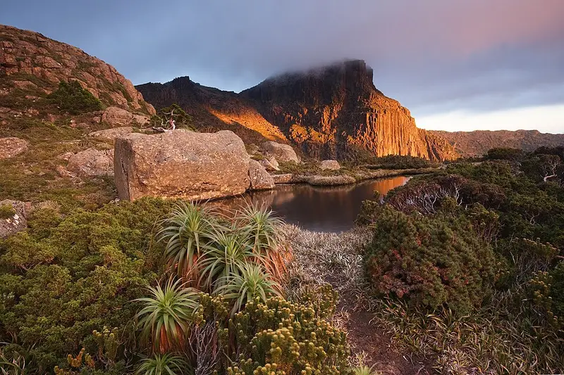
The circuit crosses peaks of white quartzite capped with red dolerite, unusual rock for the region, and passes cushion plants whose lineage goes back more than 180 million years to Gondwana. It is Grade 5, for very experienced walkers with navigation and first aid skills, and most people allow 3 to 5 days. Distance is deceptive here and the circuit has seen several rescues and deaths.
The route
Shelf Camp sits on an exposed rock slab, sheltered from the southwest but open to the northeast, where tents have been destroyed in bad weather; it has a toilet and a 3 night limit. Beyond it the route is exposed and very difficult, with boulder hopping, heights and little water. At The Notch and Mount Lot you may need to haul packs, so carry about 15 metres of rope. Lonely Tarns has tent platforms with anchoring chains and a toilet. From there to the Sarah Jane Plateau expect planking, rock slabs and mud, then a descent on planking and bridges. At the Anne River junction you can turn off for Lake Judd, 30 to 45 minutes away, where campsites near the outlet have no toilet, or carry on to Red Tape Creek.
Before you go
Overnight walkers must register, and no more than 12 independent walkers may start on any day. Carry a tent, since the only hut, at High Camp, is an emergency day shelter. This is a fuel stove only area. Red Tape Creek is 8.3 kilometres down Scotts Peak Road from Condominium Creek, so arrange a car shuffle or walk the road. There is no fuel past Maydena, phone reception is unreliable, and many walkers carry a personal locator beacon, which you can hire from Service Tasmania shops on weekdays. Carry the TASMAP 1:40,000 Mt Anne Map and Notes. Read the Mount Anne Circuit page, its walk notes and the Parks and Wildlife Service alerts page before you go.
Elevation
- Climb
- 1,300 m
- Descent
- 490 m
- Highest
- 1,377 m
- Lowest
- 567 m
Approximate, from a 30 m terrain model, so it can overstate the climb on cliff edge tracks.
Before you go
Tell your people where you are going
Set your route and return time in FriendsFindMe. If you do not check in, the people you trust are sent a text so they know to come looking for you.
Park and state forest boundaries: CAPAD 2024 © Commonwealth of Australia (DCCEEW), CC BY 4.0; © Forestry Corporation of NSW, CC BY 3.0 AU; © State of Queensland, CC BY 4.0; © State of Victoria (DEECA), CC BY 4.0
Walk data: LIST Transport Segments from theLIST © State of Tasmania, CC BY 3.0 AU