
About this walk
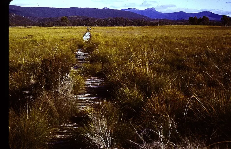
The Rasselas Track links the old osmiridium field at Adamsfield with the Vale of Rasselas and Lake Rhona, in Tasmania's south-west. This is the southern section. This walk leaves the Adamsfield Track near the Florentine River and runs north across the Gordon Plains to the Richea Creek car park, on the edge of Franklin-Gordon Wild Rivers National Park. Section 2 carries on from the Gordon River crossing to Lake Rhona.
History
Long before forestry roads reached Richea Creek, the Vale of Rasselas was reached on foot from the Adamsfield side. Ernie Bond, a miner who settled at Gordonvale in the Vale in 1934, had every load of food and gear carried in from Fitzgerald along the Adamsfield Track until a footbridge was built over the Gordon River in 1936. From 1937 he sold vegetables and preserved fruit to the shops at Adamsfield, and when he left in 1952 members of the Hobart and Launceston walking clubs helped pack his goods out to the Florentine.
What to expect
Today the Lake Rhona walk starts at Richea Creek car park. Do not assume this southern stretch is marked, cleared or easy to follow. It is remote country with no facilities. Carry a map and the skills to use it; the TASMAP 1:50,000 Denison Range map covers the Lake Rhona area. Tasmania's south-west can bring snow, rain, wind and strong sun in any month, and bushfires can occur from October to March.
The Lake Rhona walk itself is Grade 4, 28 kilometres return over 2 to 3 days, and you must register before you go. If you plan to continue north across the Gordon River, read the Parks warning about the crossing on the Lake Rhona page: the river can rise quickly after rain and has trapped walkers.
Check Parks alerts before you go, and ask the Mount Field Visitor Centre on (03) 6288 1149 about current conditions.
Elevation
- Climb
- 350 m
- Descent
- 190 m
- Highest
- 562 m
- Lowest
- 411 m
Approximate, from a 30 m terrain model, so it can overstate the climb on cliff edge tracks.
Before you go
Tell your people where you are going
Set your route and return time in FriendsFindMe. If you do not check in, the people you trust are sent a text so they know to come looking for you.
Park and state forest boundaries: CAPAD 2024 © Commonwealth of Australia (DCCEEW), CC BY 4.0; © Forestry Corporation of NSW, CC BY 3.0 AU; © State of Queensland, CC BY 4.0; © State of Victoria (DEECA), CC BY 4.0
Walk data: LIST Transport Segments from theLIST © State of Tasmania, CC BY 3.0 AU