
About this walk
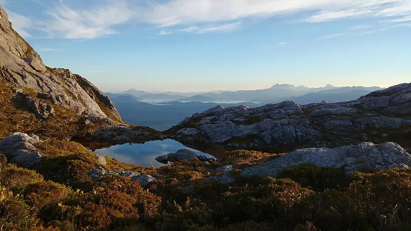
This section of the Western Arthur Range Traverse links two of the range's glacial lakes, Lake Oberon and Lake Cygnus, along the crest of the Western Arthurs in Southwest National Park, part of the Tasmanian Wilderness World Heritage Area. The range is ancient quartzite and quartz schist, with steep slopes, alpine moorland and lakes left by glaciers. The full traverse is a 58 kilometre loop from Scotts Peak of 5 to 7 days, Grade 5: very experienced walkers only, on very rough, very steep and unmarked track. Many parties walk only as far as Lake Cygnus or Lake Oberon and return, which usually takes 3 to 4 days.
The route
Lake Cygnus to Lake Oberon is 4.2 kilometres and 2.5 to 4 hours; this walk runs between the two campsites in the other direction and includes the short tracks down to them. From Lake Cygnus you climb back to the main route and follow the rocky crest south east, past Mount Hayes, with several steep climbs in and out of rocky gullies and some scrambling. The crest is very exposed to the weather. Below the saddle at Mount Orion a junction leads down to the Lake Oberon campsite, and that descent is steep and very rough, with more scrambling.
To reach Lake Cygnus in the first place, walk 8.4 kilometres from Scotts Peak to Junction Creek, then the Port Davey Track to the foot of Alpha Moraine, climb 800 metres in about 3 kilometres to the crest, and follow a route below Mount Hesperus and through the Capella Crags before dropping to the lake. Beyond Lake Oberon the traverse becomes much harder, as described in section 1.
Camping and rules
There are no huts, but Lake Cygnus and Lake Oberon both have toilets and campsites, some with tent platforms. You must register for any part of the traverse. Up to 12 independent walkers may start each day, groups of 6 are recommended and 8 is the maximum. Carry 20 metres of rope for hauling packs, and you need the TASMAP 1:50,000 Western Arthur map and a personal locator beacon. Fires are banned: it is a fuel stove only area.
Getting there and before you go
Huon Campground, at the end of Scotts Peak Road, 81 kilometres west of Mount Field, has toilets, water and parking. Fuel stops at Maydena and phone reception is patchy. Weather on the crest can turn to snow or gales in any month. Check the Western Arthur Range page, its walk notes and the Parks and Wildlife Service alerts page before you go.
Elevation
- Climb
- 440 m
- Descent
- 430 m
- Highest
- 1,046 m
- Lowest
- 853 m
Approximate, from a 30 m terrain model, so it can overstate the climb on cliff edge tracks.
Before you go
Tell your people where you are going
Set your route and return time in FriendsFindMe. If you do not check in, the people you trust are sent a text so they know to come looking for you.
Park and state forest boundaries: CAPAD 2024 © Commonwealth of Australia (DCCEEW), CC BY 4.0; © Forestry Corporation of NSW, CC BY 3.0 AU; © State of Queensland, CC BY 4.0; © State of Victoria (DEECA), CC BY 4.0
Walk data: LIST Transport Segments from theLIST © State of Tasmania, CC BY 3.0 AU