
About this walk
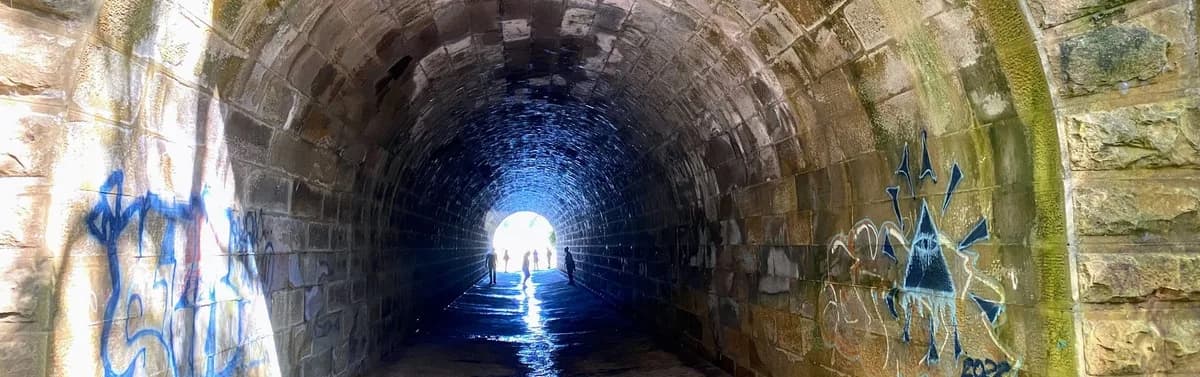
This is one of my favourite big day walks in Brisbane Water National Park. It follows the Tunnel Fire Trail off Woy Woy Road, drops down to Mullet Creek and ends at a hand cut sandstone tunnel that carries the creek right under the Sydney to Newcastle railway line. On a warm, clear day the pool beside it is perfect for a swim, and standing inside the tunnel looking up at the stone arch is quietly astonishing.
The tunnel is living history. The culvert was built in the 1880s to let Mullet Creek pass beneath the main northern railway, and the ridge above holds the Woy Woy railway tunnel, which at nearly 1.7km was the longest railway tunnel in Australia when it opened in 1888. Thousands of people ride straight over this Victorian era engineering every day without knowing it is there.
It is a proper 12km return, mostly on fire trail, with a steep pinch down to the creek and back up again. Bring plenty of water, sturdy shoes and a sense of adventure.
Warning: only do this walk at low tide. The tunnel fills as the tide comes in, so check the tide times before you go and leave yourself plenty of time to get back.
Directions
- Start by heading off along the Tunnel Trail: -33.48118,151.29511 (Google Maps)
- Turn right along the Mullet Creek Fire Trail: -33.46066,151.30967 (Google Maps)
- Leave the Mullet Creek Fire Trail and take the track down the hill, go over the tunnel and climb down the blue rope on the other side: -33.48533,151.26687 (Google Maps)
- You have reached the tunnel. Admire the sandstone arch, wander through to the far side and swim if the water is clear enough: -33.48458,151.26586 (Google Maps)
If you have the energy, take the short side trip to the mouth of the Woy Woy railway tunnel itself, a huge sandstone portal cut straight into the ridge. It is worth the detour. There are no facilities once you leave the road, so carry everything you need, watch the tide and let someone know your plan before you set out.
Elevation
- Climb
- 30 m
- Descent
- 150 m
- Highest
- 143 m
- Lowest
- 18 m
Approximate, from a 30 m terrain model, so it can overstate the climb on cliff edge tracks.
Before you go
Tell your people where you are going
Set your route and return time in FriendsFindMe. If you do not check in, the people you trust are sent a text so they know to come looking for you.

The book
The cave walks are in the book
A Cornucopia of Central Coast Walks includes the Megacave Loop and both the short and long walks to Ritcher's Cave, each with a map and numbered directions, alongside over 100 other walks on the Coast.
See the bookThe original walk notes and photos on Good Architect
Park and state forest boundaries: CAPAD 2024 © Commonwealth of Australia (DCCEEW), CC BY 4.0; © Forestry Corporation of NSW, CC BY 3.0 AU; © State of Queensland, CC BY 4.0; © State of Victoria (DEECA), CC BY 4.0