
About this walk
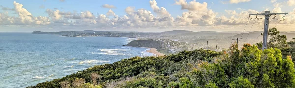
A scenic trail along the cliffs between Bateau Bay and Forresters Beach, with sweeping ocean views, coastal wildflowers and the chance to spot whales in season. It is one of the most popular coastal walks on the Central Coast, well marked and easy to follow, and great for families and visitors after a short walk with sea views. Come back along the beach, or car shuffle, for the full experience.
It is also one of the best places on the coast to watch the sunrise, with some wonderful spots to swim. To car shuffle, leave one car near Wyrrabalong Lookout, then drive to the start in the other.
Directions
- Start at Shelly Beach: -33.37264933171299, 151.4874637126923 (Google Maps)
- Just past Blue Lagoon Caravan Park, duck into the bush on the left: -33.37834755504049, 151.4840841293335 (Google Maps)
- Enjoy the views at Crackneck Point and keep an eye out for whales: -33.39425759791221, 151.48275375366214 (Google Maps)
- You have reached Wyrrabalong Lookout. If you are walking back, turn around here: -33.40475519806349, 151.47524356842044 (Google Maps)
- This is your car shuffle spot: -33.40662, 151.47154 (Google Maps)
Elevation
- Climb
- 160 m
- Descent
- 80 m
- Highest
- 127 m
- Lowest
- 9 m
Approximate, from a 30 m terrain model, so it can overstate the climb on cliff edge tracks.
Before you go
Tell your people where you are going
Set your route and return time in FriendsFindMe. If you do not check in, the people you trust are sent a text so they know to come looking for you.

The book
Find a sunrise lookout in the book
A Cornucopia of Central Coast Walks indexes its lookouts, including Mt Ettalong, Warrah, Wyrrabalong and Winney Bay, so you can pick a view for first light from over 100 walks. Each walk has a map and numbered directions for setting off in the dark.
See the bookThe original walk notes and photos on Good Architect
Park and state forest boundaries: CAPAD 2024 © Commonwealth of Australia (DCCEEW), CC BY 4.0; © Forestry Corporation of NSW, CC BY 3.0 AU; © State of Queensland, CC BY 4.0; © State of Victoria (DEECA), CC BY 4.0