
About this walk
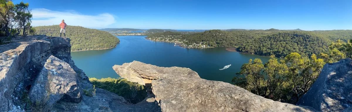
This is my favourite walk on the Central Coast, by a long way. Spion Kop is a dramatic outcrop shaped like a skull, with a bay on either side and views reaching all the way to Lion Island. Coming in this way involves a bit of a scramble, so if you would prefer an easier route, try the Spion Kop Return from Bambina Road (13km) instead. That said, this is the quickest way there, and you pass some wonderful caves on the way. The red river in the valley between the two ridges is worth a visit on its own. Allow around four hours.
It is also the best way into the bush from the residential streets of Koolewong.
Spion Kop is a bit hard to find, so keep the map open and check your location against the track as you go.
Directions
- Start behind the bus stop and head up the hill: -33.46163,151.31220 (Google Maps)
- Turn left at the red tape to cross back over the fire trail, then follow a very small dry creek bed: -33.46066,151.30967 (Google Maps)
- Turn left at the creek and follow the red rock creek down the hill: -33.46282,151.30843 (Google Maps)
- Just before the creek drops away, turn right between two boulders and head up the hill. Follow the rock cairns (small piles of stones marking the way) the rest of the way to Spion Kop: -33.46465,151.30873 (Google Maps)
- You've reached the stunning view at Spion Kop: -33.47461,151.30668 (Google Maps)
- Look for the rock cairns and tape near a crevice in the rock, then head down and follow the pink tape: -33.47167,151.30404 (Google Maps)
- You've reached the end at the Woy Woy Firetrail: -33.48439,151.30305 (Google Maps)
Elevation
- Climb
- 270 m
- Descent
- 210 m
- Highest
- 141 m
- Lowest
- 13 m
Approximate, from a 30 m terrain model, so it can overstate the climb on cliff edge tracks.
Before you go
Tell your people where you are going
Set your route and return time in FriendsFindMe. If you do not check in, the people you trust are sent a text so they know to come looking for you.

The book
15 waterfall walks in the book
A Cornucopia of Central Coast Walks has a waterfall section with 15 walks, including Somersby Falls, Gap Creek Falls, Strickland Falls and Kariong Brook Falls. Each one has a map and numbered directions, alongside over 100 other walks on the Coast.
See the bookThe original walk notes and photos on Good Architect
Park and state forest boundaries: CAPAD 2024 © Commonwealth of Australia (DCCEEW), CC BY 4.0; © Forestry Corporation of NSW, CC BY 3.0 AU; © State of Queensland, CC BY 4.0; © State of Victoria (DEECA), CC BY 4.0