
About this walk
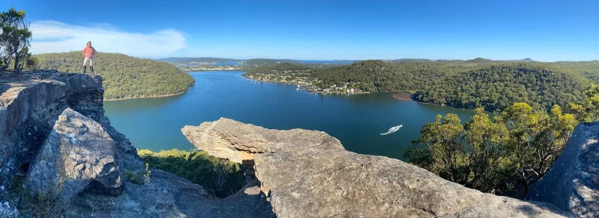
This is my favourite walk on the Central Coast, by a long way. The track leads to Spion Kop, a dramatic rock outcrop that looks a little like a skull. It sits between two bays, with sweeping views out to Lion Island and beyond. It is the kind of place that makes you stop and take it all in: quiet, wild and high above everything.
The return walk takes around four hours on a clear bush track through classic Central Coast bushland, with tall gums, sandstone caves, birds and, if you are lucky, the odd goanna. This is the easiest way to reach Spion Kop. If you want a harder but quicker route, try Koolewong to Spion Kop, which starts with a bit of a scramble.
It is one of the best kept secrets in Brisbane Water National Park, and the track is usually quiet, so it is a great choice if you want a long, peaceful walk with few people and a big reward at the end. Follow the rock cairns. Spion Kop is a bit hard to find, so we strongly recommend following a map with your location turned on.
Directions
- Start and end point: -33.452081416198546, 151.29129606310485 (Google Maps)
- Go straight ahead, keeping right: -33.45426, 151.30107 (Google Maps)
- Turn left and walk between two rocks to follow the top of Koolewong: -33.45753, 151.30705 (Google Maps)
- Turn right at the red tape to cross back over the fire trail, then follow a very small dry creek bed: -33.46066, 151.30967 (Google Maps)
- Turn left at the creek and follow the red rock creek down the hill: -33.46282, 151.30843 (Google Maps)
- Just before the creek drops away, turn right between two boulders and head up the hill. Follow the rock cairns the rest of the way to Spion Kop: -33.46465, 151.30873 (Google Maps)
- You have reached the view at Spion Kop: -33.47461, 151.30668 (Google Maps)
Elevation
- Climb
- 100 m
- Descent
- 170 m
- Highest
- 188 m
- Lowest
- 65 m
Approximate, from a 30 m terrain model, so it can overstate the climb on cliff edge tracks.
Before you go
Tell your people where you are going
Set your route and return time in FriendsFindMe. If you do not check in, the people you trust are sent a text so they know to come looking for you.

The book
15 waterfall walks in the book
A Cornucopia of Central Coast Walks has a waterfall section with 15 walks, including Somersby Falls, Gap Creek Falls, Strickland Falls and Kariong Brook Falls. Each one has a map and numbered directions, alongside over 100 other walks on the Coast.
See the bookThe original walk notes and photos on Good Architect
Park and state forest boundaries: CAPAD 2024 © Commonwealth of Australia (DCCEEW), CC BY 4.0; © Forestry Corporation of NSW, CC BY 3.0 AU; © State of Queensland, CC BY 4.0; © State of Victoria (DEECA), CC BY 4.0