
About this walk
This is the Bushrangers Bay track in Mornington Peninsula National Park, the walk between Boneo Road and the Cape Schanck car park on the southern tip of the Mornington Peninsula. It starts at the Bushrangers Bay Picnic Area on Boneo Road and finishes at Cape Schanck. It is also the 5.2 km last leg of the Two Bays Walking Trail from Dromana.
The walk
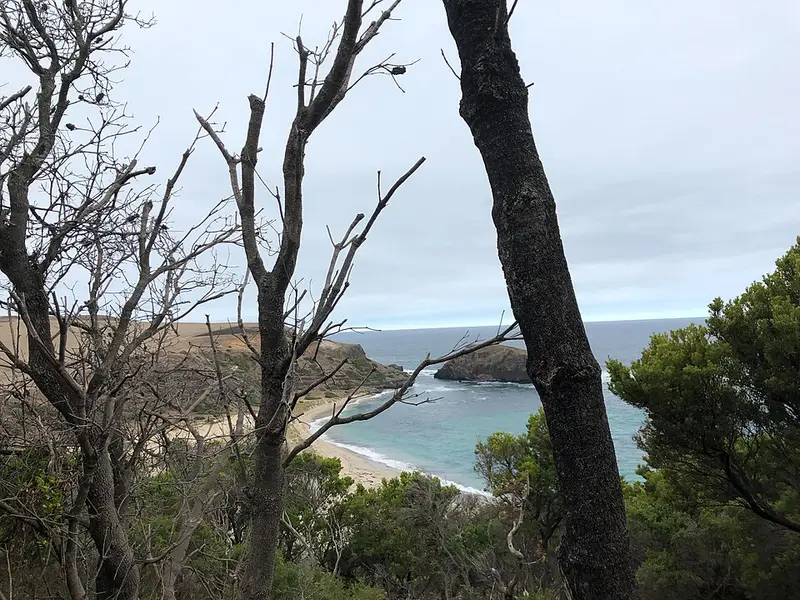
From Boneo Road the track heads south through banksia woodland, with views opening up as it nears the coast, then drops down a set of steps towards Bushrangers Bay. The bay is a sandy beach formed where Main Creek meets the sea, closed in by dark basalt cliffs. The beach itself is a short detour, about 100 metres down a long staircase. From the bay the track runs along the clifftops to Cape Schanck, with wide views over Bass Strait, the basalt cliffs and the headlands. This stretch has some of the best coastal scenery near Melbourne, and the clifftop section can be exposed and windy.
Many people walk only the coastal half: the track east from the Cape Schanck car park to Bushrangers Bay is about 2.6 km, around 2 hours return.
At Cape Schanck
The Cape Schanck Lighthouse has guided ships since 1859, and the heritage listed precinct includes a museum and the old keeper's residence. Lighthouse tours are run by a local operator. Short boardwalks lead to lookouts over Pulpit Rock and the Devils Desk, volcanic formations on the cape, and whales can be seen passing through Bass Strait. The day visitor area has picnic tables and toilets, including an accessible toilet, but no drinking water. The nearest drinking water is at Fingal Picnic Area.
Getting there
Both ends are reached from Boneo Road, about 90 km south east of Melbourne. The Boneo Road end has a small car park and picnic tables. If you are walking one way, leave a car at each end.
Before you go
Swimming at Bushrangers Bay is hazardous because of strong rips and big waves, and the beach is not patrolled. Mobile reception is poor around Cape Schanck. Dogs and horses are not allowed in the national park, bikes are not permitted on its walking only tracks, and snakes sometimes sun themselves on the path. Check the Mornington Peninsula National Park page for alerts and changed conditions before you go, and see the Cape Schanck Lighthouse Reserve page for the visitor area.
Elevation
- Climb
- 100 m
- Descent
- 120 m
- Highest
- 100 m
- Lowest
- 40 m
Approximate, from a 30 m terrain model, so it can overstate the climb on cliff edge tracks.
Before you go
Tell your people where you are going
Set your route and return time in FriendsFindMe. If you do not check in, the people you trust are sent a text so they know to come looking for you.
Park and state forest boundaries: CAPAD 2024 © Commonwealth of Australia (DCCEEW), CC BY 4.0; © Forestry Corporation of NSW, CC BY 3.0 AU; © State of Queensland, CC BY 4.0; © State of Victoria (DEECA), CC BY 4.0
Walk data: © OpenStreetMap contributors, ODbL