
About this walk
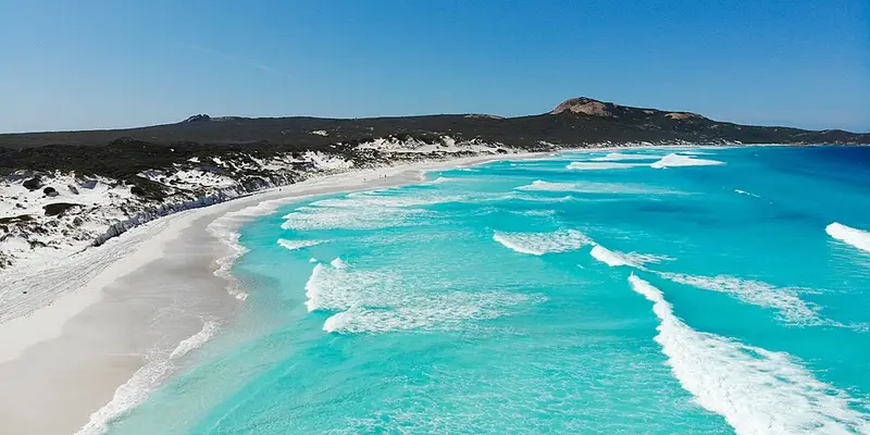
The Le Grand Coastal Trail links the bays of Cape Le Grand National Park, about 50 km east of Esperance by sealed road. It runs from Le Grand Beach in the west, past Hellfire Bay, Thistle Cove and Lucky Bay, to Rossiter Bay in the east. It is a spectacular but hard walk of about 17 to 20 km one way. It is best spread over two days, though it can be walked in about eight hours, and you can start at either end.
The stages
The trail splits into four stages at its vehicle access points. Le Grand Beach to Hellfire Bay (6.2 km, about 3 hours, Class 4) is the hardest part, climbing up and down the steep lower slopes of Mount Le Grand (345 metres), often at awkward angles, with long views over the coastal plain and the granite peaks. Hellfire Bay to Thistle Cove (4.7 km, 2 to 3 hours, Class 4) is mostly bare granite, dangerously slippery when wet, and passes the isolated beach of Little Hellfire Bay. Thistle Cove to Lucky Bay (2.5 km, about 1 hour, Class 3) is the easiest stretch, with views out to the islands of the Recherche Archipelago. Lucky Bay to Rossiter Bay (6.6 km, 2 to 3 hours, Class 3) crosses a ridge between the two bays. Lucky Bay's white sand is fine enough to squeak underfoot.
Class 3 means a moderate trail with clear signs; Class 4 means limited signs, long steep sections and slippery surfaces, and needs good fitness and some bushwalking experience.
History
Le Grand Beach is named after an officer on the L'Esperance, one of two French ships that charted this coast in 1792. Rossiter Bay recalls Captain Rossiter of the whaling ship Mississippi, which was anchored there in June 1841 when the explorer Edward John Eyre and his Aboriginal companion Wylie arrived, exhausted, after crossing the Nullarbor. Hellfire Bay is thought to take its name from St Elmo's fire, the glow that sometimes appears around ships' masts.
Facilities and getting there
There are campgrounds at Lucky Bay (56 sites) and Le Grand Beach (14 sites), with flush toilets and showers. Both must be booked online, and neither provides drinking water, so carry all you need on the trail. A vehicle entry fee applies in the park. The road from Lucky Bay to Rossiter Bay is unsealed, and the park's beaches bog vehicles easily. Fires are not allowed anywhere in the park, and pets are not permitted. There are no bins, so take your rubbish out.
Before you go
Much of the western half crosses bare granite, which turns dangerously slippery after rain, so plan around the weather. Feral bees nest in the area, so steer clear of active hives. Clean mud off your boots before you arrive to avoid spreading dieback, a soil mould that kills native plants. Phone coverage is not guaranteed, so download the Emergency+ app and leave your plans with someone. Check Parks and Wildlife park alerts before you go, and see the Cape Le Grand National Park page and the Trails WA Coastal Trail page for maps.
Elevation
- Climb
- 680 m
- Descent
- 690 m
- Highest
- 156 m
- Lowest
- 2 m
Approximate, from a 30 m terrain model, so it can overstate the climb on cliff edge tracks.
Before you go
Tell your people where you are going
Set your route and return time in FriendsFindMe. If you do not check in, the people you trust are sent a text so they know to come looking for you.
Park and state forest boundaries: CAPAD 2024 © Commonwealth of Australia (DCCEEW), CC BY 4.0; © Forestry Corporation of NSW, CC BY 3.0 AU; © State of Queensland, CC BY 4.0; © State of Victoria (DEECA), CC BY 4.0
Walk data: © OpenStreetMap contributors, ODbL