
About this walk
This is Section 12, the last section of the Larapinta Trail: the climb from Redbank Gorge to the summit of Mt Sonder (Rutjupma) in Tjoritja / West MacDonnell National Park. The trail's official end is the summit itself, after about 231 km along the West MacDonnell Ranges from the Alice Springs Telegraph Station. This walk covers the climb one way, from the Redbank Gorge car park to the top. You come back on the same track, so the outing is 15 to 15.8 km return and 6 hours, Grade 4, moderate to difficult, on a rough track with long steep sections.
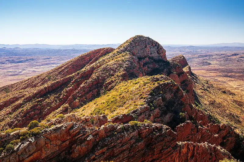
The climb
Mt Sonder is the fourth highest mountain in the Northern Territory, at 1,379 metres. It is 2.3 km (about an hour) from the car park to a saddle, then 5.6 km (2.5 hours) on to the summit, and 2.5 hours back down. A cairn marks the top. The summit has views over ranges, plains, valleys and salt lakes, and on a clear day you can pick out Tnorala / Gosse Bluff. In September and October look for the bright pink flowers of mountain hakea along the way. An early morning climb keeps the steep part out of the heat of the day.
For a shorter outing, there is a walk to the Mt Sonder Lookout and back, 5 km and 2.5 hours, including steep sections of stone steps.
There is a composting toilet near the summit. Check the conditions page to see whether it is working, and carry a toilet kit anyway. There is no water supply beyond the Redbank Gorge tanks, so carry all the water you need for the round trip.
Getting there and facilities
Redbank Gorge is about 156 km west of Alice Springs along Larapinta and Namatjira Drives, which are sealed. The last 5 km into the gorge is unsealed. Plan on a high clearance 4WD. Roads can be impassable for a short time after heavy rain. There are two booked campgrounds, Ridgetop and Woodland, both with toilets, fire pits and picnic tables. Woodland also has free gas barbecues and is the only one that takes caravans. Ranger maintained water tanks at the day use area and campground should be treated before drinking. Pets are not permitted, and a Parks Pass applies to visitors from outside the Territory.
Redbank Gorge itself is worth the short walk: a grade 3 track, 2 km return, leads up the sandy creek bed to a near permanent waterhole. The water is very cold, so take a flotation device if you swim through the gorge.
Before you go
The recommended walking season is April to September. Carry a satellite phone or personal locator beacon, tell someone reliable your plans, and fill in the trailhead logbook. Check the Larapinta Trail current conditions and the Redbank Gorge page before you go. Section 11, from the Finke River, finishes at the same car park.
Elevation
- Climb
- 730 m
- Descent
- 80 m
- Highest
- 1,350 m
- Lowest
- 680 m
Approximate, from a 30 m terrain model, so it can overstate the climb on cliff edge tracks.
Before you go
Tell your people where you are going
Set your route and return time in FriendsFindMe. If you do not check in, the people you trust are sent a text so they know to come looking for you.
Park and state forest boundaries: CAPAD 2024 © Commonwealth of Australia (DCCEEW), CC BY 4.0; © Forestry Corporation of NSW, CC BY 3.0 AU; © State of Queensland, CC BY 4.0; © State of Victoria (DEECA), CC BY 4.0
Walk data: © OpenStreetMap contributors, ODbL