
About this walk
The Ormiston Pound Walk is a loop from the visitor centre at Ormiston Gorge in Tjoritja / West MacDonnell National Park, 135 km west of Alice Springs. It is 8.5 km, 3 to 4 hours, Grade 3, moderate. It climbs around the slopes beside the gorge, drops onto the wide, flat floor of Ormiston Pound, a basin ringed by ranges, and comes back through Ormiston Gorge past the main waterhole.
What you see
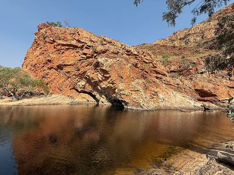
The gorge has a permanent waterhole about 500 metres from the walks information shelter, estimated at up to 14 metres deep at its southern end. The area holds relict plants left over from Central Australia's wetter tropical past, and the rediscovery here in 1997 of the long tailed dunnart and the central rock rat marked the park as an important refuge for wildlife. You may see black footed rock wallabies near the gorge. Out on the Pound floor you look toward Mt Giles, which at 1,389 metres is the third highest peak in the Northern Territory.
The water crossing
When the waterhole is high, finishing the loop through the gorge can mean a short swim through deep, very cold water. Do not start if you are not prepared to swim. Most waterholes in the park are cold enough to cause hypothermia even in summer, so plan to keep your gear and phone dry, and never jump or dive in.
Facilities and getting there
Ormiston Gorge is reached by sealed roads, Larapinta and Namatjira Drives, and the visitor centre and kiosk are about 8 km from the turnoff on Namatjira Drive. The campground has gas barbecues, toilets and showers, takes all vehicles including caravans, and must be booked online. The kiosk sells basic supplies, with opening hours that vary. Drinking water at the gorge is limited, and tank and surface water should be treated, so bring what you need. Fires and pets are not permitted, and a Parks Pass applies to visitors from outside the Territory.
Nearby walks
Shorter options from the same shelter include the Ghost Gum Lookout (1.2 km return) and the Ghost Gum Walk (2.5 km loop). Two longer walks head on from the Pound, where the marked track ends and you follow the creek bed: Bowmans Gap, about 9 km one way to the north, and Mt Giles, a Grade 5 walk of 2 to 3 days with a hard climb to the summit. Ormiston Gorge is also where Sections 9 and 10 of the Larapinta Trail meet, and Larapinta walkers can switch to a day pack here to walk the Pound loop.
Before you go
The cooler months, April to September, are the most pleasant. From October to April the heat can pass 40°C, so start early and carry plenty of water. Check the Ormiston Gorge page for its current site status before you set out.
Elevation
- Climb
- 190 m
- Descent
- 200 m
- Highest
- 774 m
- Lowest
- 658 m
Approximate, from a 30 m terrain model, so it can overstate the climb on cliff edge tracks.
Before you go
Tell your people where you are going
Set your route and return time in FriendsFindMe. If you do not check in, the people you trust are sent a text so they know to come looking for you.
Park and state forest boundaries: CAPAD 2024 © Commonwealth of Australia (DCCEEW), CC BY 4.0; © Forestry Corporation of NSW, CC BY 3.0 AU; © State of Queensland, CC BY 4.0; © State of Victoria (DEECA), CC BY 4.0
Walk data: © OpenStreetMap contributors, ODbL