
About this walk
The Albert River circuit is a loop off the Border Track in the Green Mountains section of Lamington National Park, part of the Gondwana Rainforests of Australia World Heritage Area. The full walk is a 21.8 kilometre circuit from the Green Mountains day use area, about 7 hours, on a Grade 4 track (bushwalking experience recommended; tracks can be long, rough and steep). This walk is the loop itself, which leaves the Border Track about 5 kilometres from the trailhead, so add the Border Track there and back to its length.
What you see
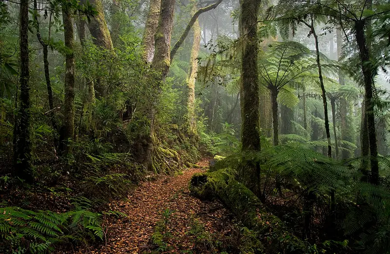
Walk it anticlockwise. You drop off the Border Track through Antarctic beech forest into a rainforest gully at Echo Falls, then climb beside a branch of the Albert River to Echo Point lookout. From there the view runs along the McPherson Range from Mount Wupawn to Mount Durigan and south to the Tweed Range, all part of the eroded caldera around Mount Warning, the old volcanic plug that the Bundjalung people call Wollumbin. The track then follows the state border east to Cominan lookout and turns north west to rejoin the Border Track. In September the beech orchid, Dendrobium falcorostrum, flowers on the trunks of the old beech trees.
Camping
Echo Point bush camp is on the circuit, about 9 kilometres and 3 hours from the trailhead, and 300 metres from the lookout, where you can watch sunrise over the coast and the mouth of the Tweed River. It sits at about 1,000 metres with little shelter from wind, takes up to 6 people, must be booked, and opens only from 1 February to 30 November. There are no facilities: treat creek water, carry a fuel stove and take all rubbish out. Mount Bithongabel bush camp is on the Border Track on the way, about 6.5 kilometres in.
Getting there and facilities
The Green Mountains day use area is at the end of Lamington National Park Road, 36 kilometres of narrow, winding bitumen from Canungra, at least 50 minutes and unsuitable for caravans and RVs over 6 metres. It has flush toilets, picnic tables, free electric barbecues and an information centre.
Before you go
The Black Canyon area nearby is a restricted access area, so keep to the track. Watch for leeches, ticks and stinging trees, and do not start a long walk after midday. Mobile coverage is unreliable, though you can sometimes get a signal at lookouts. Check the Queensland Parks alerts and the Albert River circuit page before you go.
Elevation
- Climb
- 400 m
- Descent
- 400 m
- Highest
- 1,149 m
- Lowest
- 866 m
Approximate, from a 30 m terrain model, so it can overstate the climb on cliff edge tracks.
Before you go
Tell your people where you are going
Set your route and return time in FriendsFindMe. If you do not check in, the people you trust are sent a text so they know to come looking for you.
Park and state forest boundaries: CAPAD 2024 © Commonwealth of Australia (DCCEEW), CC BY 4.0; © Forestry Corporation of NSW, CC BY 3.0 AU; © State of Queensland, CC BY 4.0; © State of Victoria (DEECA), CC BY 4.0
Walk data: Queensland Parks and Wildlife Service access © The State of Queensland 2025, CC BY 4.0