
About this walk
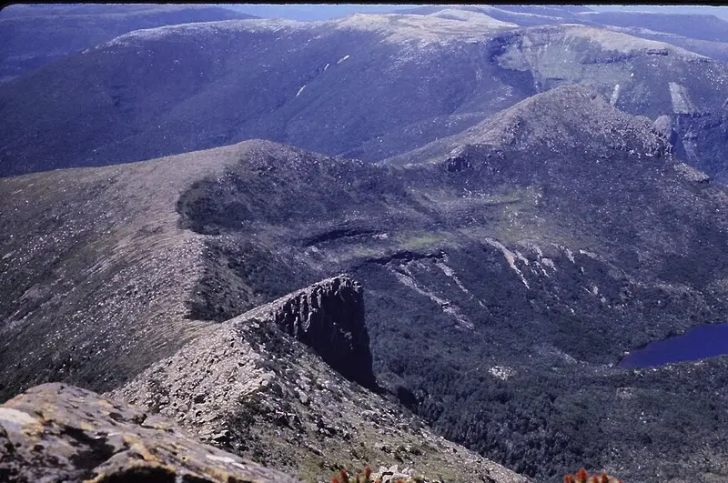
Precipitous Bluff, known to walkers as PB, is a 1,145 metre mountain of columnar dolerite rising above New River Lagoon in Southwest National Park, part of the Tasmanian Wilderness World Heritage Area. This walk is the western half of the Southern Ranges traverse: from Pindars Peak, where the Moonlight Ridge Track from Lune River ends, west over Leaning Tea Tree Saddle and the Wylly Plateau, up Precipitous Bluff and down its far side to the shore of New River Lagoon. From there walkers wade about 7 kilometres along the lagoon edge to Prion Beach and the South Coast Track.
The limestone around PB was briefly threatened by mining in the 1970s, and the area faced logging until it became part of the national park. The summit campsite, close to the cliff edge, has one of the best views in Tasmania: rugged ranges on one side and New River Lagoon about a kilometre below on the other.
What it is like
This is a route rather than a built track. Only a few hundred metres of boardwalk exist, and the going ranges from fair by southwest Tasmanian standards to a steep, muddy, rutted trench that turns into a creek in rain, with heavy scrub from Low Camp towards Pindars Peak. Trouble spots are the scrubby, boggy ground of Leaning Tea Tree Saddle, the saddle below Kameruka Moraine, and PB Low Camp, where several false pads lead off into the scrub. Below the cliffs of PB on the descent to the lagoon the route is poorly marked and taped, so stay with the tape.
Times vary widely. Pindars Peak to the Wylly Plateau can take about 5 hours and Low Camp under 4 more, but weather can hold you at Leaning Tea Tree Saddle for a full day. Camping is limited at the saddle, and dry spots between pools are hard to find.
New River Lagoon
The descent finishes through forest at Cavern Camp on the lagoon. The lagoon wade is mostly calf deep in normal conditions, but after heavy rain it can be chest deep, with detours inland at creek mouths where the current is too strong. The lagoon drops fairly quickly once rain stops.
Before you go
You need strong navigation skills, a GPS track and a tent that can take high wind, plus spare food for days lost to weather and a personal locator beacon. The full traverse from Lune River to Cockle Creek is about 88 kilometres and most parties take 9 to 10 days. A Tasmanian parks pass is required. Check the Southwest National Park page, the South Coast Track page and the Parks and Wildlife Service alerts page before you go.
Elevation
- Climb
- 860 m
- Descent
- 2,000 m
- Highest
- 1,147 m
- Lowest
- 13 m
Approximate, from a 30 m terrain model, so it can overstate the climb on cliff edge tracks.
Before you go
Tell your people where you are going
Set your route and return time in FriendsFindMe. If you do not check in, the people you trust are sent a text so they know to come looking for you.
Park and state forest boundaries: CAPAD 2024 © Commonwealth of Australia (DCCEEW), CC BY 4.0; © Forestry Corporation of NSW, CC BY 3.0 AU; © State of Queensland, CC BY 4.0; © State of Victoria (DEECA), CC BY 4.0
Walk data: LIST Transport Segments from theLIST © State of Tasmania, CC BY 3.0 AU