
About this walk
This is the eastern part of the South Coast Track, the 85 kilometre walk across the southern edge of Southwest National Park, part of the Tasmanian Wilderness World Heritage Area. This walk starts on the eastern bank of the New River Lagoon outlet at Prion Beach, where walkers coming from Melaleuca finish rowing across, and ends at Cockle Creek on Recherche Bay. Section 1 covers Melaleuca to the lagoon. The whole track is Grade 4, which means bushwalking experience is recommended and tracks may be long, rough and very steep with limited signs.
The route
This stretch takes three days. From the Prion Beach campsite to Granite Beach is 12 kilometres, 5 to 6.5 hours, with short climbs, clambering and rock hopping. Granite Beach is a mix of sand and large stones that needs careful footing, and the campsite is at the far end. Many walkers instead camp at Osmiridium Beach, 2 to 2.5 hours on from the boat crossing and a short detour off the track (1.2 kilometres, about 30 minutes return).
Granite Beach to South Cape Rivulet is only 9 kilometres but takes 7 to 10 hours, and it is reputedly the hardest day of the whole track. It is a long climb through forest over the South Cape Range, often boggy and knotted with tree roots, to a campsite at the end of South Cape Bay.
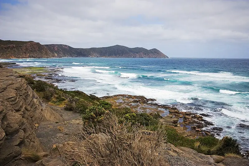
The last day, 11 kilometres and 3.5 to 4.5 hours, is beaches and mud. You cross a long headland, come down to the last beach with Lion Rock standing out in the sea, climb a set of stairs off the sand and cross the buttongrass of Blowhole Valley to Cockle Creek. The section from Cockle Creek to South Cape Bay is also a day walk, at 18 kilometres and 4 hours return.
Mud and water
After rain the muddy stretches can run for several kilometres and be over knee deep, and most streams have no bridge and are normally a knee deep wade. Streams can flood after heavy rain but usually drop quickly, so wait rather than cross a flooded one. Strong winds, steady rain and snow on high ground can come at any time of year.
Cockle Creek
Cockle Creek is about 2 hours south of Hobart through Huonville and Geeveston, past the Hastings Caves turn off and through Lune River and Ida Bay. The final stretch is gravel but suits a normal car with care, and there is no fuel beyond Southport. In peak summer, booked bus services run between Hobart and Cockle Creek. There are two camping areas with toilets, plus toilets by the Ranger Quarters; the tank at Boltons Green is untreated, so boil the water or bring your own. Volunteer caretakers usually staff the Ranger Quarters in summer only. Dogs are not allowed in the national park, and the park is fuel stove only.
Before you go
Most walkers go west to east, because flights out of Melaleuca depend on the weather. If you start here, sign the walkers' logbook, carry enough food for delays, and remember there are no huts until Melaleuca. You need a Tasmanian parks pass. See the South Coast Track page, the walk notes and the Cockle Creek page, and check the Parks and Wildlife Service alerts page before you go.
Elevation
- Climb
- 1,450 m
- Descent
- 1,450 m
- Highest
- 465 m
- Lowest
- 2 m
Approximate, from a 30 m terrain model, so it can overstate the climb on cliff edge tracks.
Before you go
Tell your people where you are going
Set your route and return time in FriendsFindMe. If you do not check in, the people you trust are sent a text so they know to come looking for you.
Park and state forest boundaries: CAPAD 2024 © Commonwealth of Australia (DCCEEW), CC BY 4.0; © Forestry Corporation of NSW, CC BY 3.0 AU; © State of Queensland, CC BY 4.0; © State of Victoria (DEECA), CC BY 4.0
Walk data: LIST Transport Segments from theLIST © State of Tasmania, CC BY 3.0 AU