
About this walk
This is the Guthega to Charlotte Pass walk in Kosciuszko National Park, the first day of the Snowies Alpine Walk, a 56 kilometre, four day route that links Guthega, Charlotte Pass, Mount Kosciuszko, Perisher Valley and Bullocks Flat. You can walk it either way between Charlotte Pass and Guthega Village. It is 9 kilometres one way, about 3 hours, Grade 3. It opened in June 2022 as stage 2 of the Snowies Alpine Walk.
What it is like
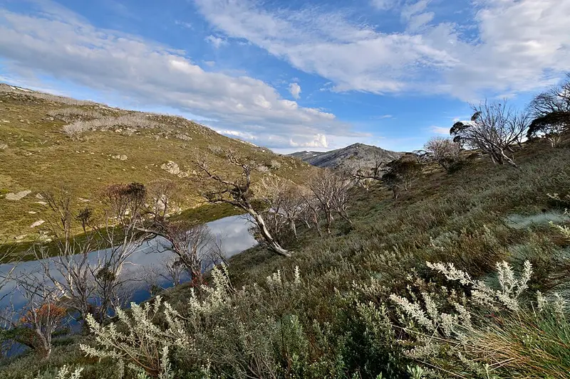
From Guthega the track starts with views over Guthega Pondage, then follows the upper Snowy River valley through alpine heath and snow gums, taking in the older Illawong walk along the way. About 3 kilometres from Guthega you cross Spencers Creek on the highest suspension bridge in Australia, at about 1,627 metres above sea level. The Main Range comes into view within the first hour and can hold snow even in summer. Creeks run hard with snowmelt in late spring, and billy buttons and snow daisies flower through summer.
The track is clearly signposted and formed, with some obstacles, short steep hills and many steps, and needs no previous experience. Parts are stone paved, and raised steel mesh walkways carry it over fragile alpine ground. Stay on the track. Cycling is not permitted on it, wood fires are banned in the alpine area, and pets are not allowed.
Getting there
To start at Guthega, drive from Jindabyne along Kosciuszko Road towards Perisher and turn onto Guthega Road. It is sealed as far as Guthega power station, then unsealed for about 6.5 kilometres to the village, where you park at the Guthega Centre. Charlotte Pass is at the end of Kosciuszko Road, past Smiggin Holes and Perisher Valley, on sealed road. Parking near the Charlotte Pass trackhead is limited, so arrive early or book a shuttle with a local operator; the Snowy Region Visitor Centre in Jindabyne (02 6450 5600) can tell you who runs them. A shuttle also gets you back to your car, since the walk is one way. Park entry fees apply on Kosciuszko Road.
Facilities
There are non flush toilets at Guthega and Charlotte Pass, but none at Illawong in between. The cafes in both villages open only in peak holiday periods, and there is no drinking water on the walk, so carry all you need.
Before you go
From June to October the track is under snow, with no snow poles marking the route, and private cars cannot reach Guthega or Charlotte Pass. In those months it suits only cross country skiers or snowshoers with backcountry winter experience. Weather in the high country can turn at any time of year, so pack warm and waterproof layers. Mobile reception in the park is limited. You can hire a personal locator beacon for free from the Snowy Region Visitor Centre, the Perisher Valley office, or the Tumut and Khancoban visitor centres, and NPWS offers a trip intention form for leaving your plans with someone. Check the Guthega to Charlotte Pass walk alerts before you go, and download the map from the NSW National Parks walk page.
At Charlotte Pass the walk meets the Main Range walk over Mount Kosciuszko, which is the second day of the Snowies Alpine Walk, and the 12.7 kilometre walk on to Perisher Valley, which is the third.
Elevation
- Climb
- 170 m
- Descent
- 300 m
- Highest
- 1,770 m
- Lowest
- 1,589 m
Approximate, from a 30 m terrain model, so it can overstate the climb on cliff edge tracks.
Before you go
Tell your people where you are going
Set your route and return time in FriendsFindMe. If you do not check in, the people you trust are sent a text so they know to come looking for you.
Park and state forest boundaries: CAPAD 2024 © Commonwealth of Australia (DCCEEW), CC BY 4.0; © Forestry Corporation of NSW, CC BY 3.0 AU; © State of Queensland, CC BY 4.0; © State of Victoria (DEECA), CC BY 4.0
Walk data: © State of New South Wales (NSW National Parks and Wildlife Service), CC BY 4.0