
About this walk
This is the Charlotte Pass Village to Perisher Valley walk in Kosciuszko National Park, the third of the four stages of the Snowies Alpine Walk. It runs one way from Charlotte Pass to Perisher Valley: 12.7 km, 4 to 6 hours, Grade 3: a formed, signposted track with some obstacles, short steep hills and many steps, for walkers with some bushwalking experience and moderate fitness.
The route
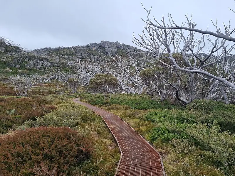
The track was built as part of the Snowies Alpine Walk, and this stage opened in 2023. Its construction included about 1,665 metres of raised steel mesh walkway, 861 rock steps and more than 6.7 km of rock paving. It crosses high country plains and creeks, through snow gum woodland, with views of the snow covered ranges early in the season, wildflowers in summer, and wombats and echidnas if you are lucky.
Near Perisher it joins the older Porcupine walk, which crosses snow grass and snow gums to Porcupine Rocks, a group of granite boulders with wide views over the Main Range and the Thredbo Valley. They can be very windy. From there the track drops into Perisher Valley and finishes at the Perisher Valley reservoir.
Getting there
The road to Charlotte Pass is sealed, the way to the Perisher trackhead is partly unsealed, and parking is limited at both ends, so arrive early, share a car, or book a shuttle through the Snowy Region Visitor Centre. For the Perisher end, drive 33 km along Kosciuszko Road from Jindabyne, take the first left 400 metres past the Man from Snowy River Hotel, then the first right, and follow the road to the gravel carpark at the reservoir. You can also park in the main Perisher carpark near the NPWS office and walk 700 metres along Porcupine Road and Galaxia Place to the trackhead. Park entry fees apply: $17 per vehicle per day for most of the year and $29 in winter.
Facilities and rules
There are toilets at Charlotte Pass and Perisher Valley, and flush toilets at the NPWS Perisher office in summer, 8:30am to 4:30pm on weekdays. Carry drinking water. Cycling is not permitted on this walk, nor are pets, open fires or recreational drones. You may camp along the way, but not in the Perisher drinking water catchment around the Rock Creek reservoir.
Before you go
From June to October the walk is under snow and only passable on skis or snowshoes, with no snow poles to follow, and private cars cannot reach Charlotte Pass; snow can fall in any month. Mobile reception is limited. Fill in a trip intention form, and hire a personal locator beacon free from the Snowy Region Visitor Centre in Jindabyne or the Perisher Valley office.
The Snowies Alpine Walk runs 56 km over 4 days, from Guthega to Charlotte Pass, round the Main Range, on to Perisher, then down to Bullocks Flat. Check the Charlotte Pass to Perisher alerts before you go, and see the NSW National Parks walk page and the Snowies Alpine Walk page.
Elevation
- Climb
- 410 m
- Descent
- 430 m
- Highest
- 1,917 m
- Lowest
- 1,732 m
Approximate, from a 30 m terrain model, so it can overstate the climb on cliff edge tracks.
Before you go
Tell your people where you are going
Set your route and return time in FriendsFindMe. If you do not check in, the people you trust are sent a text so they know to come looking for you.
Park and state forest boundaries: CAPAD 2024 © Commonwealth of Australia (DCCEEW), CC BY 4.0; © Forestry Corporation of NSW, CC BY 3.0 AU; © State of Queensland, CC BY 4.0; © State of Victoria (DEECA), CC BY 4.0
Walk data: © State of New South Wales (NSW National Parks and Wildlife Service), CC BY 4.0