
About this walk
This is the Mount Kosciuszko Summit walk, the old road from Charlotte Pass to the top of Australia's highest mountain, 2,228 metres, in Kosciuszko National Park. This walk follows it one way between Charlotte Pass and the summit. Return, it is 18.6 km, 6 to 8 hours, Grade 3, on a formed, clearly signposted track with short steep hills and occasional steps. NPWS closed the road to public vehicles in 1976 for safety and environmental reasons.
The route
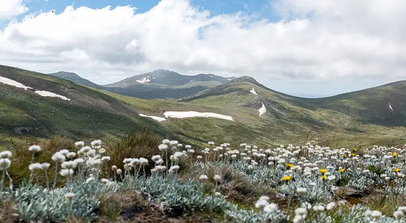
From Charlotte Pass the road runs through snow gums, heath and herbfields with wide views of the Main Range. About 4.5 km in it crosses the Snowy River, a good place for a break. It then climbs to Seamans Hut, about 6 km from the start, a stone hut built in 1929 in memory of skiers Laurie Seaman and Evan Hayes, who died in a snowstorm in 1928. It is kept as an emergency shelter. Rawson Pass comes at about 7.6 km, and from there it is 1.4 km on foot to the summit. Early summer brings marsh marigolds, silver snow daisies, mountain roses and buttercups to the herbfields.
Mountain bikes, including fat bikes, may use the road between Charlotte Pass and Rawson Pass, where there are bike stands. Riders must give way to walkers and walk the last stretch to the summit. There are toilets at Charlotte Pass, Seamans Hut and Rawson Pass. Carry your own drinking water.
Getting there
Drive Kosciuszko Road from Jindabyne past Perisher to Charlotte Pass, about 40 km and 30 minutes. Parking near the trackhead fills on weekends. Park entry fees apply on Kosciuszko Road: $17 per vehicle per day for most of the year and $29 from the June to October long weekends.
Before you go
From June to October the walk is under snow and private cars cannot drive between Perisher and Charlotte Pass. You can ski or snowshoe it, but no snow poles mark the route. Snow can fall in any month, and conditions on the range change fast, so carry clothing for all weather, a map and a compass or GPS, check the Bureau of Meteorology forecast, and turn back if bad weather is coming. Mobile reception is limited. Pets, open fires and recreational drones are not permitted.
You can combine this walk with the Main Range walk, a 22 km loop that returns to Charlotte Pass along this road, or come up from Thredbo on the Kosciuszko walk to Rawson Pass. Check the summit walk alerts before you go, and see the NSW National Parks summit walk page for the details.
Elevation
- Climb
- 20 m
- Descent
- 400 m
- Highest
- 2,223 m
- Lowest
- 1,841 m
Approximate, from a 30 m terrain model, so it can overstate the climb on cliff edge tracks.
Before you go
Tell your people where you are going
Set your route and return time in FriendsFindMe. If you do not check in, the people you trust are sent a text so they know to come looking for you.
Park and state forest boundaries: CAPAD 2024 © Commonwealth of Australia (DCCEEW), CC BY 4.0; © Forestry Corporation of NSW, CC BY 3.0 AU; © State of Queensland, CC BY 4.0; © State of Victoria (DEECA), CC BY 4.0
Walk data: © State of New South Wales (NSW National Parks and Wildlife Service), CC BY 4.0