
About this walk
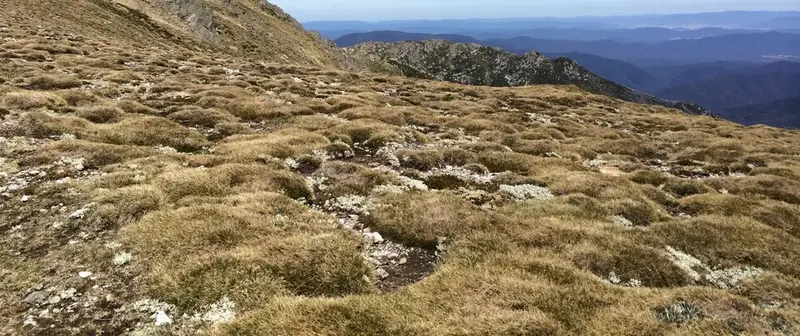
This is the Main Range track in Kosciuszko National Park, the high, exposed path from Charlotte Pass along the roof of the Snowy Mountains to Mount Kosciuszko. This walk runs from Charlotte Pass to where the track meets the summit road just below the top. With the Mount Kosciuszko Summit walk it makes the Main Range walk, a 22 km loop of 7 to 9 hours, Grade 4. It is very steep, with many steps, on a formed and clearly signposted track with some obstacles, and some bushwalking experience is recommended.
The route
The walk starts by rock hopping across the Snowy River on stepping stones below Charlotte Pass. Do not do the walk if the stepping stones are under water. Because the crossing comes first when you walk the loop this way round, you find out early whether you can go on.
The track then climbs through alpine herbfields past the Hedley Tarn lookout to the Blue Lake lookout, about 5 km from Charlotte Pass. Blue Lake is a cirque lake, a basin carved by glaciers, about 28 metres deep, and has been listed as a wetland of international importance since 1996. From there the track climbs Carruthers Peak, with views west, and follows the exposed ridge above Club Lake and Lake Albina until it meets the summit road between Rawson Pass and the summit. Turn right for the top, then return to Charlotte Pass down the old road past Seamans Hut. Some stretches are on raised steel mesh walkways, which can be sharp; running on them is not recommended.
Facilities and rules
There are toilets at Rawson Pass, Seamans Hut and Charlotte Pass, and nothing in between. Carry your water. Bikes are not allowed on the Main Range, and pets, open fires and recreational drones are not permitted. Backcountry camping is possible if you are well equipped, but read the NPWS backcountry camping rules first, and carry out all your rubbish.
Getting there
Drive Kosciuszko Road from Jindabyne past Smiggin Holes and Perisher Valley to Charlotte Pass, about 40 km. Park outside the 20 minute area; there is street parking along Kosciuszko Road. Park entry fees apply: $17 per vehicle per day for most of the year and $29 in winter.
Before you go
From June to October the track is under snow, the road beyond Perisher is closed to private cars, and no snow poles mark the route. Snow can fall at any time of year, and the ridge is open to wind and storms, so check the forecast for Thredbo Top Station and do not start if bad weather is coming. Mobile reception is limited. Fill in a trip intention form, and hire a personal locator beacon free from the Snowy Region Visitor Centre in Jindabyne or the Perisher Valley office.
The Main Range walk is also the second stage of the four day Snowies Alpine Walk. Check the Main Range walk alerts before you go, and see the NSW National Parks Main Range walk page for the details.
Elevation
- Climb
- 300 m
- Descent
- 620 m
- Highest
- 2,162 m
- Lowest
- 1,719 m
Approximate, from a 30 m terrain model, so it can overstate the climb on cliff edge tracks.
Before you go
Tell your people where you are going
Set your route and return time in FriendsFindMe. If you do not check in, the people you trust are sent a text so they know to come looking for you.
Park and state forest boundaries: CAPAD 2024 © Commonwealth of Australia (DCCEEW), CC BY 4.0; © Forestry Corporation of NSW, CC BY 3.0 AU; © State of Queensland, CC BY 4.0; © State of Victoria (DEECA), CC BY 4.0
Walk data: © State of New South Wales (NSW National Parks and Wildlife Service), CC BY 4.0