
About this walk
This is the middle of the Cape to Cape Track in Leeuwin-Naturaliste National Park, Western Australia: the southern half of the coast between Augusta and Margaret River. It picks up on Deepdene Beach and runs north past Hamelin Bay, through Boranup Forest and past Conto and Redgate to the edge of Prevelly, just south of the Margaret River mouth. The whole track runs between the Cape Leeuwin and Cape Naturaliste lighthouses; it is 130 km and most people take 5 to 7 days, but plenty of road access points let you walk it in pieces.
The route
Deepdene campsite sits in a sand blowout at the northern end of Deepdene Beach, and it is easy to miss: watch for the gap in the dunes. North of there the track passes Cosy Corner and a limestone shelf full of blowholes on the way to Hamelin Bay, about 9 km on, where stingrays glide through the shallows and there is a holiday park. From Hamelin Bay a long beach walk and the regrowth karri of Boranup Forest take you about 22 km to Conto. Karri is one of the tallest trees in the world, and the forest is one of the few inland stretches of the track. The cliffs above Conto Beach lead on to Redgate Beach (Redgate to Conto Road is 6.6 km, a popular day walk) and Bobs Hollow, then inland through peppermint woodland to Boodjidup Brook, the only stream on the whole track with a proper bridge. Lake Cave and Mammoth Cave are a short way inland.
Underfoot
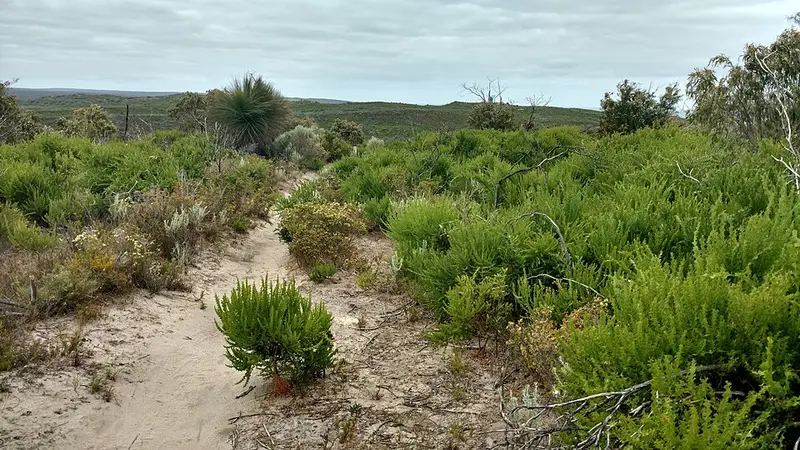
Expect soft beach sand, old 4WD tracks, rough limestone paths and some built steps. The track is Class 4, meaning rough ground, limited signage, and a need for bushwalking experience and good fitness. The southern half is the more remote and harder half.
Camping and water
Deepdene is a free walkers' camp with a long drop toilet, picnic table and rainwater tank but no shelter; treat the water. Conto Campground, a large campground on the track, and the small Boranup Campground, seven sites on the edge of the karri forest just off the track, are national park campgrounds with camping fees, and both must be booked online. Neither provides drinking water. There is no vehicle entry fee for the park. Carry 4 litres per person per day when camping, because tanks can run dry. Campfires are banned at the walkers' camps, and dogs and bikes are not allowed on the track.
Before you go
Mobile coverage is patchy to absent along much of this section. Summer is hot with little shade, so do not walk on days of Extreme or Catastrophic fire danger; prescribed burns can also close parts of the track. Check Parks and Wildlife park alerts and the Friends of the Cape to Cape Track alerts before you go, and see the Explore Parks WA Cape to Cape Track page and the Conto Campground page for bookings.
Elevation
- Climb
- 820 m
- Descent
- 700 m
- Highest
- 194 m
- Lowest
- 3 m
Approximate, from a 30 m terrain model, so it can overstate the climb on cliff edge tracks.
Before you go
Tell your people where you are going
Set your route and return time in FriendsFindMe. If you do not check in, the people you trust are sent a text so they know to come looking for you.
Park and state forest boundaries: CAPAD 2024 © Commonwealth of Australia (DCCEEW), CC BY 4.0; © Forestry Corporation of NSW, CC BY 3.0 AU; © State of Queensland, CC BY 4.0; © State of Victoria (DEECA), CC BY 4.0
Walk data: © OpenStreetMap contributors, ODbL