
About this walk
This is the northern half of the Cape to Cape Track in Leeuwin-Naturaliste National Park, Western Australia. It starts at Prevelly, crosses the mouth of the Margaret River and follows the coast north past Ellensbrook, Gracetown, Moses Rock and Yallingup to finish at Cape Naturaliste Lighthouse. The whole track runs between the lighthouses at Cape Leeuwin and Cape Naturaliste, and the two sections before this one cover the coast south to Cape Leeuwin. The full track is 130 km and 5 to 7 days.
The route
The first job is the river. For most of the year you can wade the Margaret River with care across the sand bar at its mouth, but in winter (roughly June to October) it can run deep and fast. Then walkers take an inland detour along Caves Road and over Peirce Bridge. Walking south, note that there is no vehicle access on the north bank: if the mouth cannot be crossed, the only option is to go back the way you came.
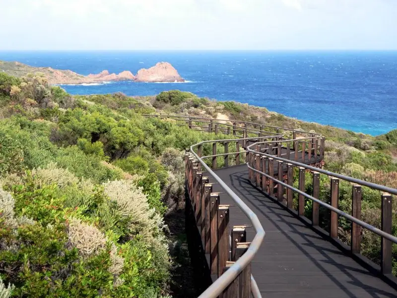
North of the river, the walk breaks into four days. Prevelly to Ellensbrook (10.3 km) crosses Kilcarnup Beach, then climbs a vehicle track through marri and jarrah forest with good orchids in season; the historic Ellensbrook Homestead is nearby. Ellensbrook to Moses Rock (19.1 km) passes Gracetown, where there is a general store, and the high Wilyabrup Cliffs. Moses Rock to Yallingup (23.4 km) is a long day past Quininup Falls, Injidup, Canal Rocks and a rock pool known as the Aquarium. Yallingup to Cape Naturaliste (14.1 km) passes Smiths Beach and Sugarloaf Rock. The last 3.4 km, Sugarloaf Rock to the lighthouse, is sealed path and boardwalk built for assisted wheelchairs and prams, with toilets at both ends.
Underfoot
The track mixes firm paths, old 4WD tracks, rough stony ground and long soft beaches. The whole track is Class 4, needing bushwalking experience and good fitness, though many sections here are easy to moderate and the north has more road access points than the south.
Camping, water and access
Ellensbrook, Moses Rock and Mount Duckworth are free walkers' camps with a long drop toilet, picnic table and rainwater tank but no shelter. Treat tank water, and carry a full day's supply: allow 4 litres per person per day when camping. There are also caravan parks and accommodation at Prevelly, Gracetown and Yallingup. Campfires are banned on the track, and dogs and bikes are not allowed. There is no vehicle entry fee for the park. Parking at the Cape Naturaliste car park is at your own risk. Mobile reception is reasonable along the northern third, though you may need high ground.
Before you go
Check Parks and Wildlife park alerts and the Friends of the Cape to Cape Track alerts before you go, and ring Parks and Wildlife on (08) 9752 5555 about the river mouth in winter. Avoid days of Extreme or Catastrophic fire danger. The Explore Parks WA Cape to Cape Track page has maps and safety notes.
Elevation
- Climb
- 1,050 m
- Descent
- 1,100 m
- Highest
- 125 m
- Lowest
- 1 m
Approximate, from a 30 m terrain model, so it can overstate the climb on cliff edge tracks.
Before you go
Tell your people where you are going
Set your route and return time in FriendsFindMe. If you do not check in, the people you trust are sent a text so they know to come looking for you.
Park and state forest boundaries: CAPAD 2024 © Commonwealth of Australia (DCCEEW), CC BY 4.0; © Forestry Corporation of NSW, CC BY 3.0 AU; © State of Queensland, CC BY 4.0; © State of Victoria (DEECA), CC BY 4.0
Walk data: © OpenStreetMap contributors, ODbL