
About this walk
The Wardanup Trail is a loop around Yallingup, on the coast at the northern end of the Leeuwin-Naturaliste National Park. It is a 6.3 km loop from the Rabbit Hill car park, part of the Yallingup Walk Trails network.
The route
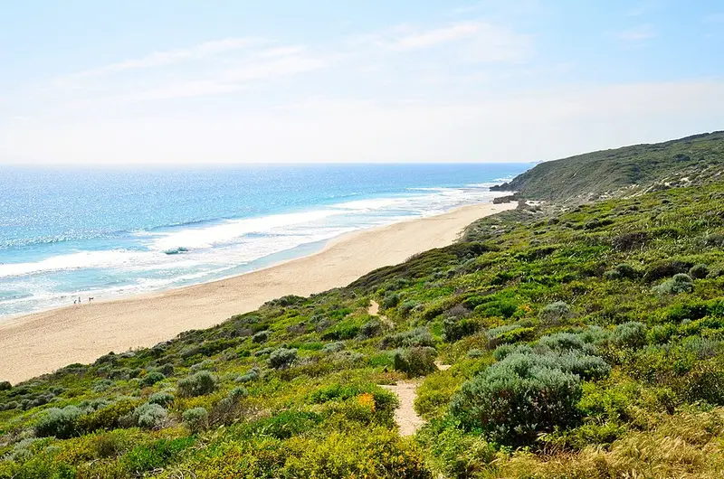
Heading north from Rabbit Hill, the trail runs along the cliff line through coastal heath, with views south over the Yallingup township and north along the coast to Sugarloaf Rock. It then climbs over Wardanup Hill through coastal peppermint forest and drops down past Ngilgi Cave. From there it descends into the valley of Yallingup Brook, passes through the township and beside Yallingup Reef, and finishes along the beach before a climb up the stairs to Rabbit Hill. Orange markers guide you around the loop. You can also start below Caves House or from the Yallingup foreshore.
What it is like
It is Class 3: a moderate trail that may have short steep hills, a rough surface, many steps or some rock hopping, needing some bushwalking experience and moderate fitness. Across the Yallingup network the terrain includes sealed footpaths, soft beach sand, steep dunes, sandy and rocky tracks and steep hills, so wear sturdy shoes. In spring the heath flowers, and humpback and southern right whales migrate along this coast.
Getting there and facilities
Yallingup is 258 km south of Perth and a 10 minute drive southwest of Dunsborough along Caves Road and Yallingup Beach Road, and the access is a 2WD road. Rabbit Hill has a car park, lookout and toilets. There are also public toilets and showers at the Yallingup Foreshore and at Smiths Beach.
Nearby
Rabbit Hill is a link to the Cape to Cape Track, which follows this coast and shares many sections of the Yallingup trails. The Torpedo and Quenda trails in the same network start from the foreshore, Smiths Beach and Torpedo Rock, so you can make the walk shorter or longer.
Check the Parks and Wildlife Service park alerts and the Leeuwin-Naturaliste National Park page before you go. Trail details and a map are on Trails WA.
Elevation
- Climb
- 210 m
- Descent
- 220 m
- Highest
- 190 m
- Lowest
- 10 m
Approximate, from a 30 m terrain model, so it can overstate the climb on cliff edge tracks.
Before you go
Tell your people where you are going
Set your route and return time in FriendsFindMe. If you do not check in, the people you trust are sent a text so they know to come looking for you.
Park and state forest boundaries: CAPAD 2024 © Commonwealth of Australia (DCCEEW), CC BY 4.0; © Forestry Corporation of NSW, CC BY 3.0 AU; © State of Queensland, CC BY 4.0; © State of Victoria (DEECA), CC BY 4.0
Walk data: © OpenStreetMap contributors, ODbL