
About this walk
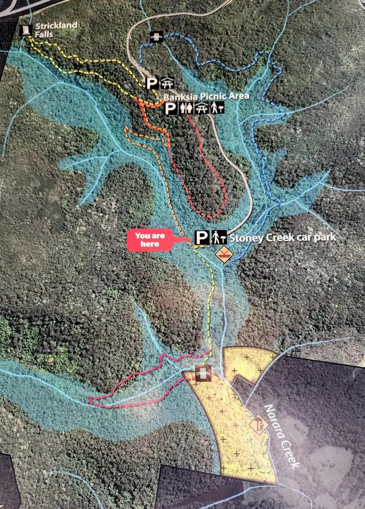
My favourite walk in Strickland. It crosses some beautiful creeks, passes through several different kinds of bush and gets your heart rate up. It joins the Ridge to Rainforest track with the Cabbage Tree Track, so expect stunning rainforest and trickling streams at the bottom, and drier forest with lovely red angophoras at the top.
Directions
- Start at the very bottom of Strickland Forest Road and head to the east side of the carpark (on your right as you drive down the hill): -33.379911, 151.324997 (Google Maps)
- Cross the road and head up to Banksia Picnic Area: -33.37169959153029, 151.32154226303103 (Google Maps)
- At the end of Banksia Picnic Area, head south (left) along the path: -33.3736528195072, 151.32291555404666 (Google Maps)
- Turn left down the hill: -33.375570165777965, 151.32293701171878 (Google Maps)
- Turn left back towards the carpark: -33.37985268377522, 151.3241815567017 (Google Maps)
Elevation
- Climb
- 140 m
- Descent
- 140 m
- Highest
- 164 m
- Lowest
- 39 m
Approximate, from a 30 m terrain model, so it can overstate the climb on cliff edge tracks.
Before you go
Tell your people where you are going
Set your route and return time in FriendsFindMe. If you do not check in, the people you trust are sent a text so they know to come looking for you.

The book
The cave walks are in the book
A Cornucopia of Central Coast Walks includes the Megacave Loop and both the short and long walks to Ritcher's Cave, each with a map and numbered directions, alongside over 100 other walks on the Coast.
See the bookThe original walk notes and photos on Good Architect
Park and state forest boundaries: CAPAD 2024 © Commonwealth of Australia (DCCEEW), CC BY 4.0; © Forestry Corporation of NSW, CC BY 3.0 AU; © State of Queensland, CC BY 4.0; © State of Victoria (DEECA), CC BY 4.0